

In today's visually-driven world, the ability to present information in an engaging and immersive manner is more critical than ever. One technology that stands out in this regard is 3D mapping. By transforming complex data into visually stunning and interactive experiences, 3D maps are revolutionizing how we understand and interact with our environment. From urban planning and real estate to environmental conservation and tourism, the applications of 3D maps are vast and varied.
The Power of 3D Visualization
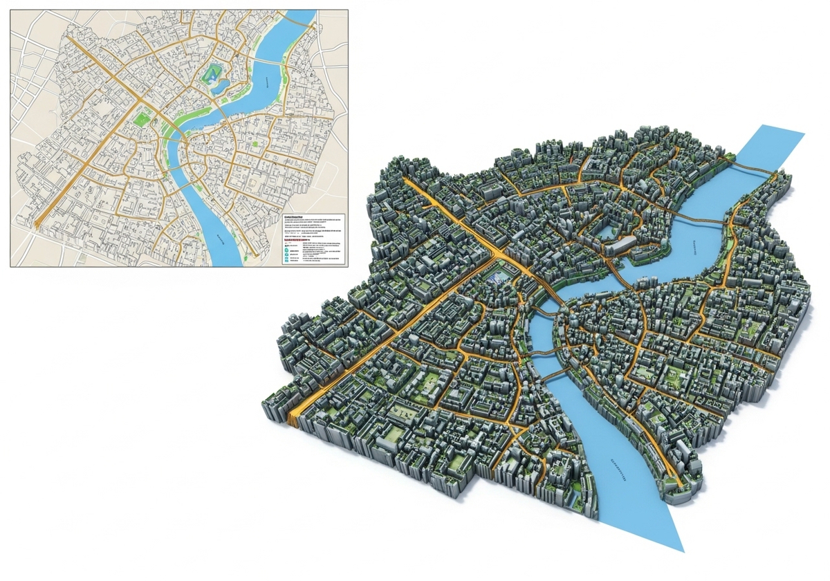
Traditional 2D maps have long been a staple for navigation and spatial understanding. However, they often fall short in conveying the full picture, especially when dealing with complex terrains or urban landscapes. 3D maps bridge this gap by adding a crucial element: depth. This allows for a more realistic and intuitive representation of the world, making it easier for viewers to grasp spatial relationships and contextual details.
Applications Across Industries
Urban Planning and Development
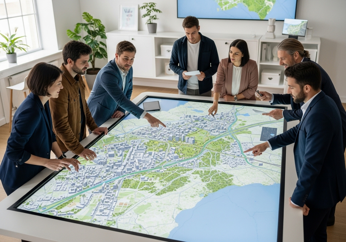
3D maps are invaluable tools for urban planners and developers. They provide a realistic visualization of proposed projects, allowing stakeholders to assess the impact on the surrounding environment. With 3D renderings, it's easier to evaluate factors like building height, shadow analysis, and traffic flow, leading to better-informed decisions and more sustainable urban development.
Real Estate
In the real estate industry, 3D maps offer potential buyers an immersive experience of properties and their surroundings. Potential buyers can explore neighborhoods, assess nearby amenities, and visualize the property from different angles, all from the comfort of their homes. This level of detail can significantly enhance the buying experience and increase engagement.
Environmental Conservation
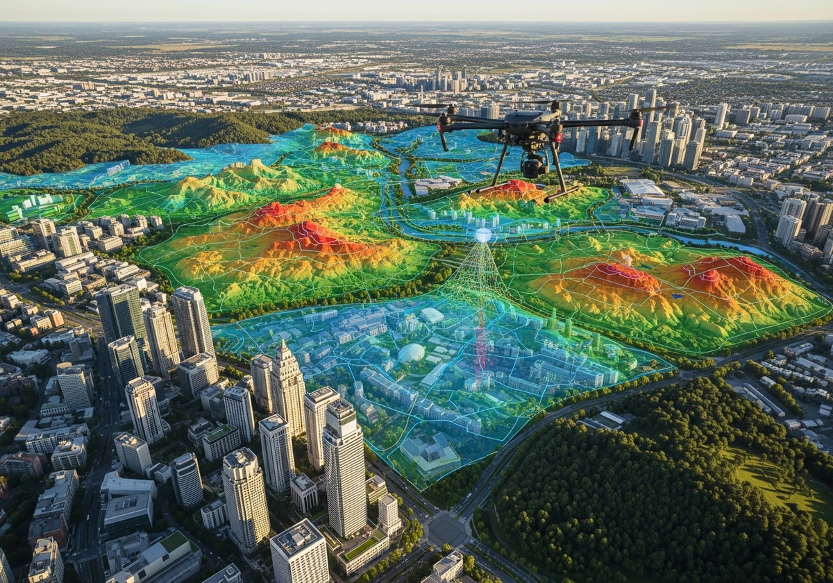
3D mapping plays a crucial role in environmental conservation efforts. Techniques like terrain modeling and geographic information system mapping allow scientists and conservationists to monitor changes in landscapes, track deforestation, and assess the impact of climate change. These visualizations help raise awareness and inform conservation strategies.
Tourism and Recreation
For the tourism industry, 3D maps can create engaging and interactive experiences for travelers. Imagine exploring a national park or historical site through a detailed 3D model, complete with annotations and multimedia content. This immersive approach can enhance the visitor experience and provide a deeper understanding of the location's history and significance.
Key Technologies Behind 3D Maps
Several technologies enable the creation of 3D maps, each with its own strengths and applications:
Geographic Information System (GIS) Mapping: GIS software is used to collect, analyze, and visualize spatial data. It forms the foundation for creating accurate and detailed 3D models.
Drone Mapping Services: Drones equipped with high-resolution cameras can capture aerial imagery and LiDAR data, which are then processed to create 3D maps of large areas quickly and efficiently.
Terrain Modeling: This technique involves creating digital representations of the Earth's surface, allowing for realistic visualizations of landscapes and terrains.
3D Rendering: Advanced rendering software is used to create realistic visualizations of buildings, landscapes, and other features, enhancing the overall immersive experience.
Conclusion
3D maps are transforming the way we interact with spatial data, offering immersive experiences that enhance understanding and engagement across various industries. From urban planning to environmental conservation, the applications of 3D mapping are vast and continue to expand as technology advances. Geographic information services, drone mapping services, and advanced rendering techniques are at the forefront of this revolution, enabling the creation of detailed and interactive 3D models. At Flyer View Group, LLC, we understand the power of data visualization. We are committed to helping our clients tell their stories through innovative solutions. Contact us today to discover how our expertise in data, maps, motion, and graphics can bring your vision to life. Check out our portfolio to see some of our recent work!