

In today's data-driven world, economic planning and decision-making require more than just spreadsheets and conventional analysis. Integrating geographic data through Geographic Information Services (GIS) offers a distinct advantage, providing a spatial perspective that enhances understanding, communication, and strategic planning. Let's explore the GIS advantage and how it's transforming economic development.
Visualizing Data With a GIS Mapping System
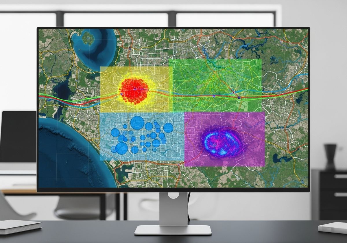
A GIS mapping system transforms raw data into visual representations, making it easier to identify patterns, trends, and relationships. By plotting economic indicators, demographic data, infrastructure, and other relevant information on a map, decision-makers can gain insights that would be difficult to discern from tables or charts alone. This visualization capability is crucial for understanding the spatial distribution of economic activities and resources.
GIS in Urban Planning
GIS plays a pivotal role in urban planning by enabling planners to analyze and model urban environments. With GIS urban planning tools, one can assess land use, transportation networks, zoning regulations, and environmental factors. This holistic approach supports informed decisions about infrastructure development, resource allocation, and sustainable growth strategies. GIS helps create more livable, efficient, and resilient cities.
3D Map Rendering for Enhanced Visualization
Taking visualization a step further, 3D map rendering provides a realistic and immersive view of geographic data. This technology is particularly useful for showcasing proposed development projects, visualizing terrain variations, and assessing the impact of new construction on the surrounding environment. 3D renderings facilitate better communication and engagement with stakeholders, fostering support for economic development initiatives.
Interactive Maps for Websites
In today's digital age, an interactive map for website is an invaluable tool for attracting investment, promoting tourism, and engaging with the community. These maps allow users to explore geographic data, search for properties, and access information about local amenities. By providing a user-friendly interface to geographic information, interactive maps empower stakeholders to make informed decisions and participate in the economic development process.

The Power of GIS for Economic Development
In summary, the GIS advantage lies in its ability to integrate and visualize geographic data, enabling smarter economic planning and decision-making. From identifying investment opportunities to optimizing resource allocation, GIS provides a spatial perspective that drives sustainable growth and enhances community vitality. At Flyer View Group, LLC, we understand the power of GIS and offer comprehensive solutions to help our clients tell their story through data, maps, motion, and graphics. Contact us today to discover how our GIS services can benefit your organization, or explore our website to see examples of our work. We are committed to bringing best-in-class service making us the gold standard. Let us help you unlock the GIS advantage and achieve your economic development goals.