Map Brochures


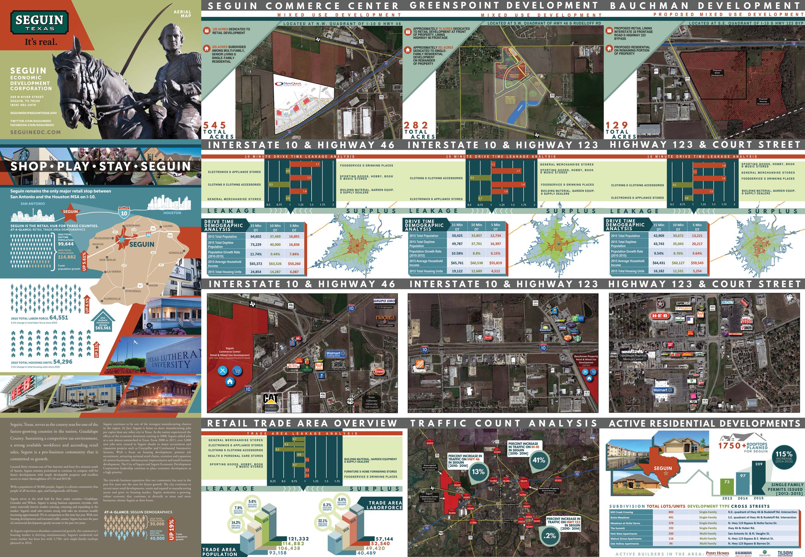
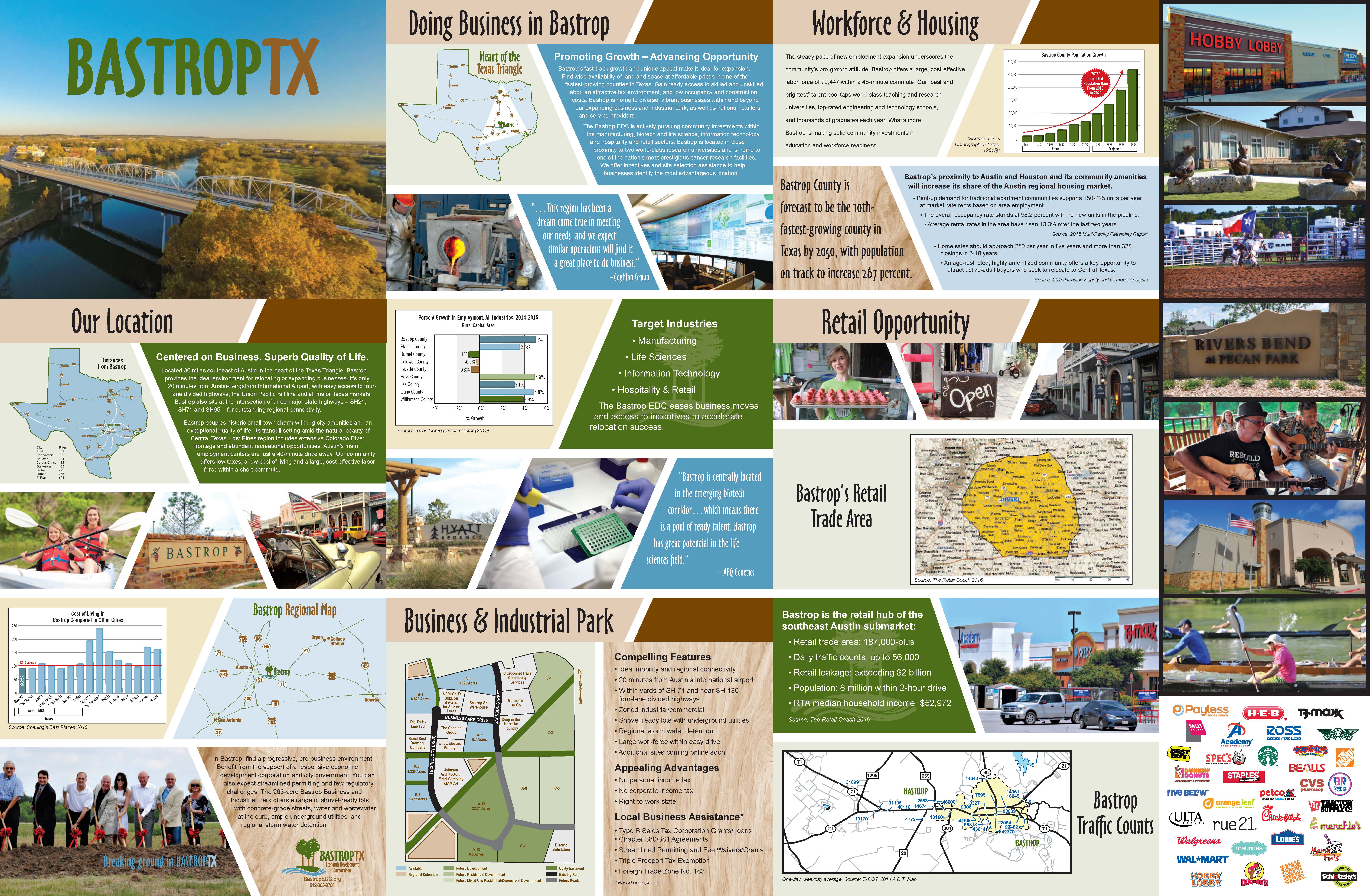
Flyer View has developed a specialty in providing high quality, professional maps that our customers rely on to conduct their business. There is much more to these products than just an enlarged aerial photograph. Unique sets of data layers can be added to customize the maps. By integrating graphics showing information pertinent to your company, community, or project you will be able communicate valuable information quickly and easily to your clients.
Our standard production process starts with high resolution aerial or satellite imagery. Then our mapping and graphics experts will add the specific data you request and enhance the image to ensure a visually appealing map poster. Our standard map posters typically include several data layers, such as: Freeways, US/State highways, major roads, points of interest, parks, major retail centers, airports, colleges/universities, and large planned communities. Some markets have additional information that have been added over the years based on feedback from
our customers. Once the maps are designed to meet your specific requirements they are printed and professionally folded to create a presentation piece that can be used in trade shows and distributed to developers, major employers, and individuals.