

Telling Your Story Through Data, Maps, Motion & Graphics
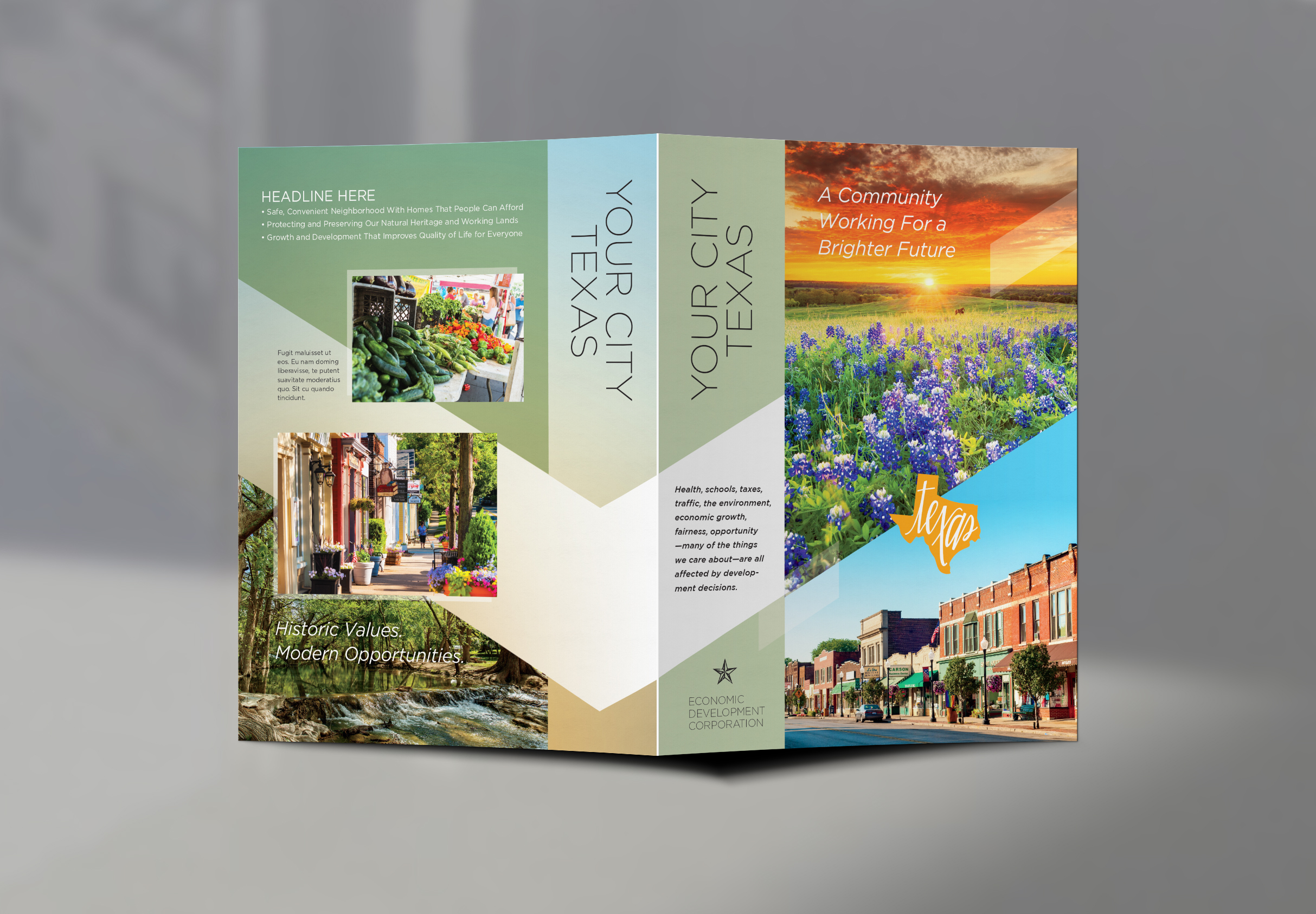
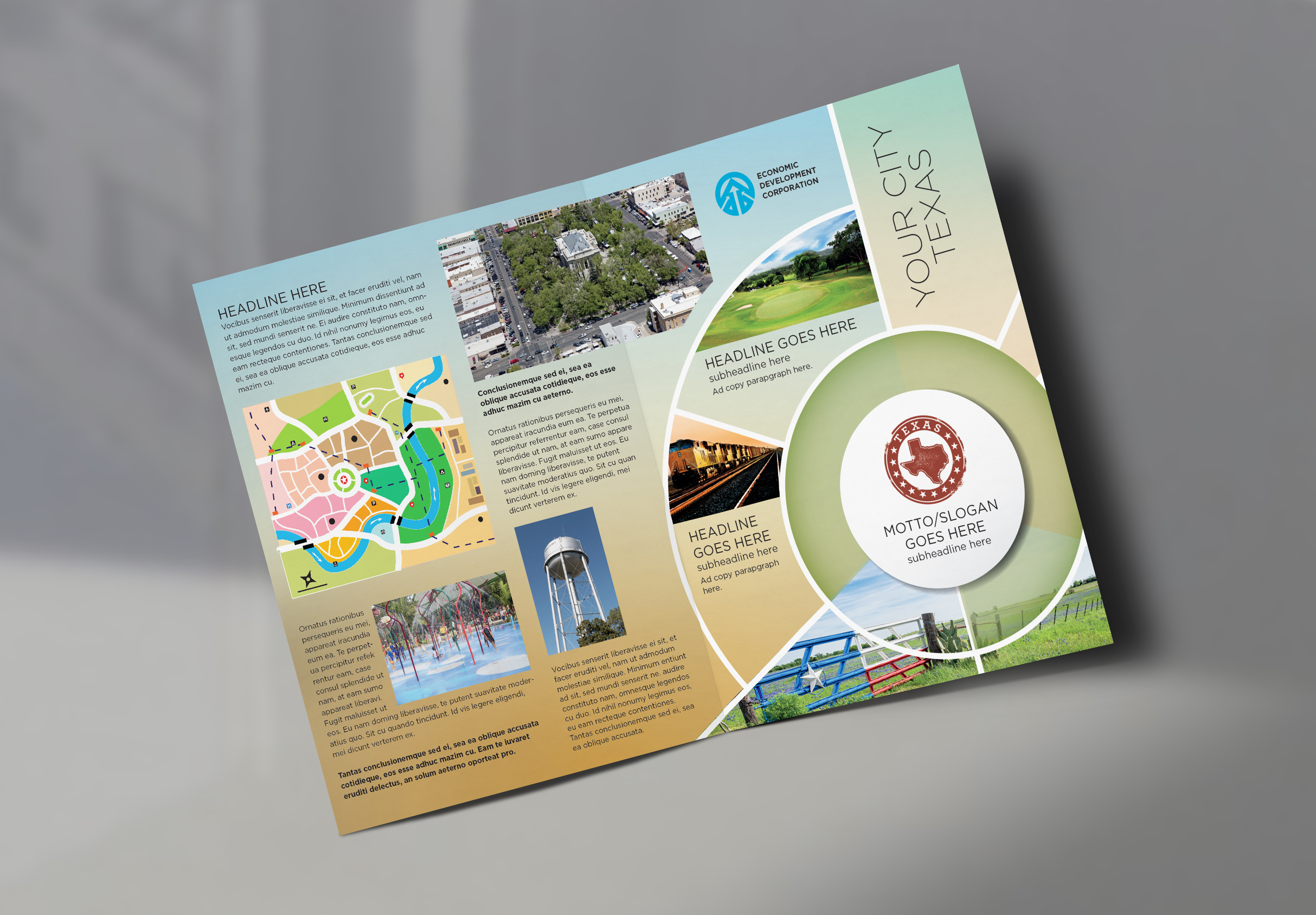
Map Posters & Brochures
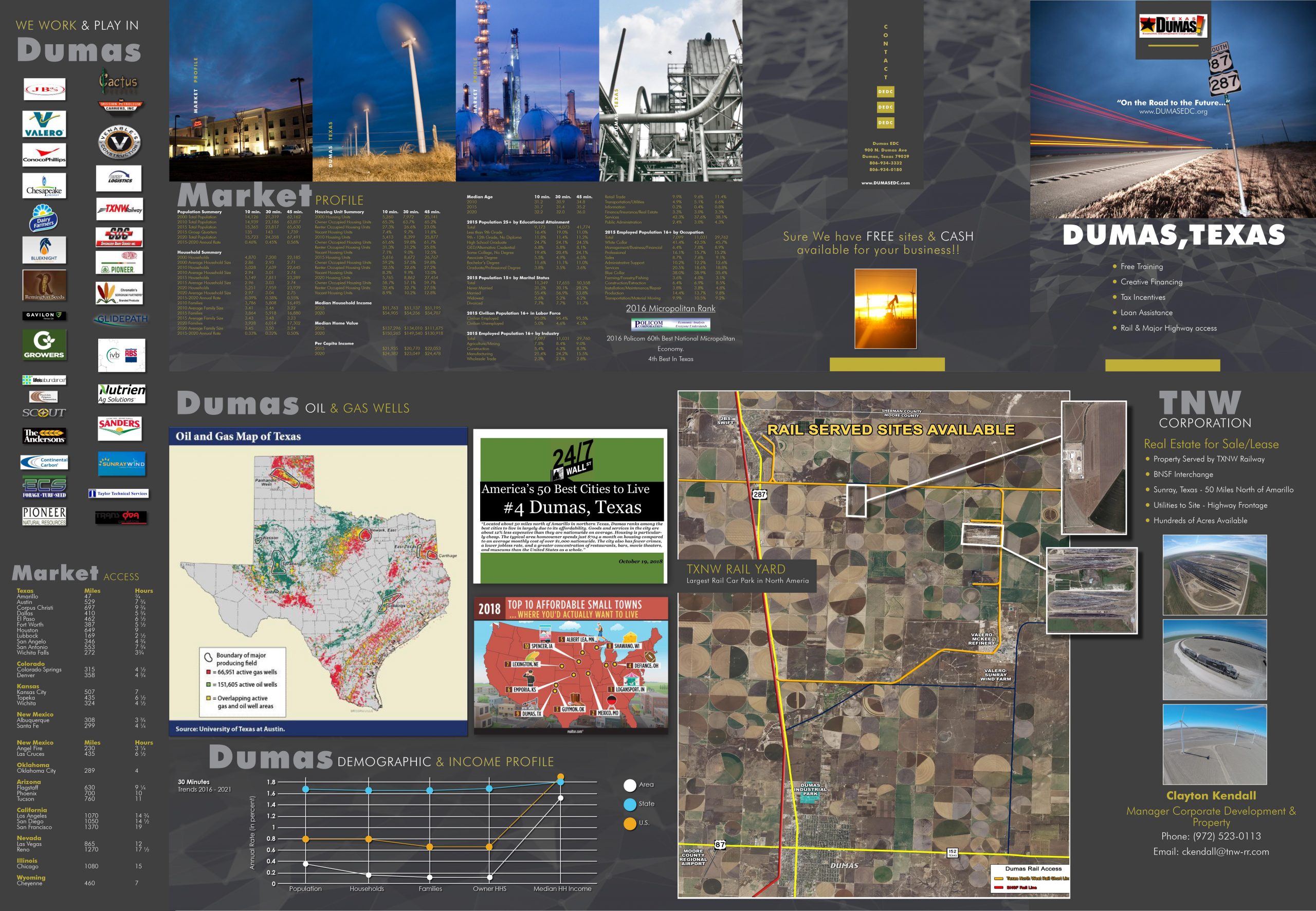
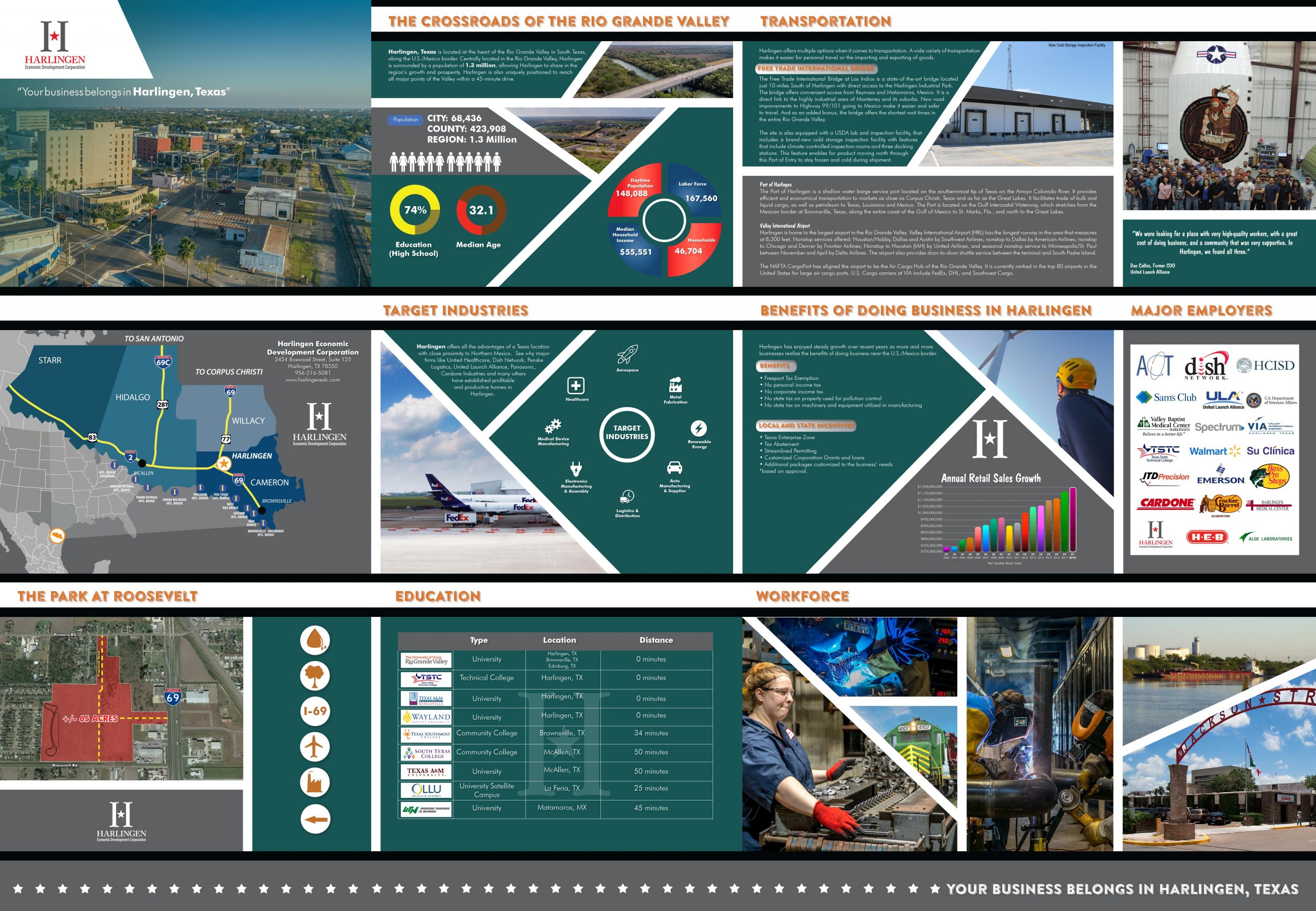
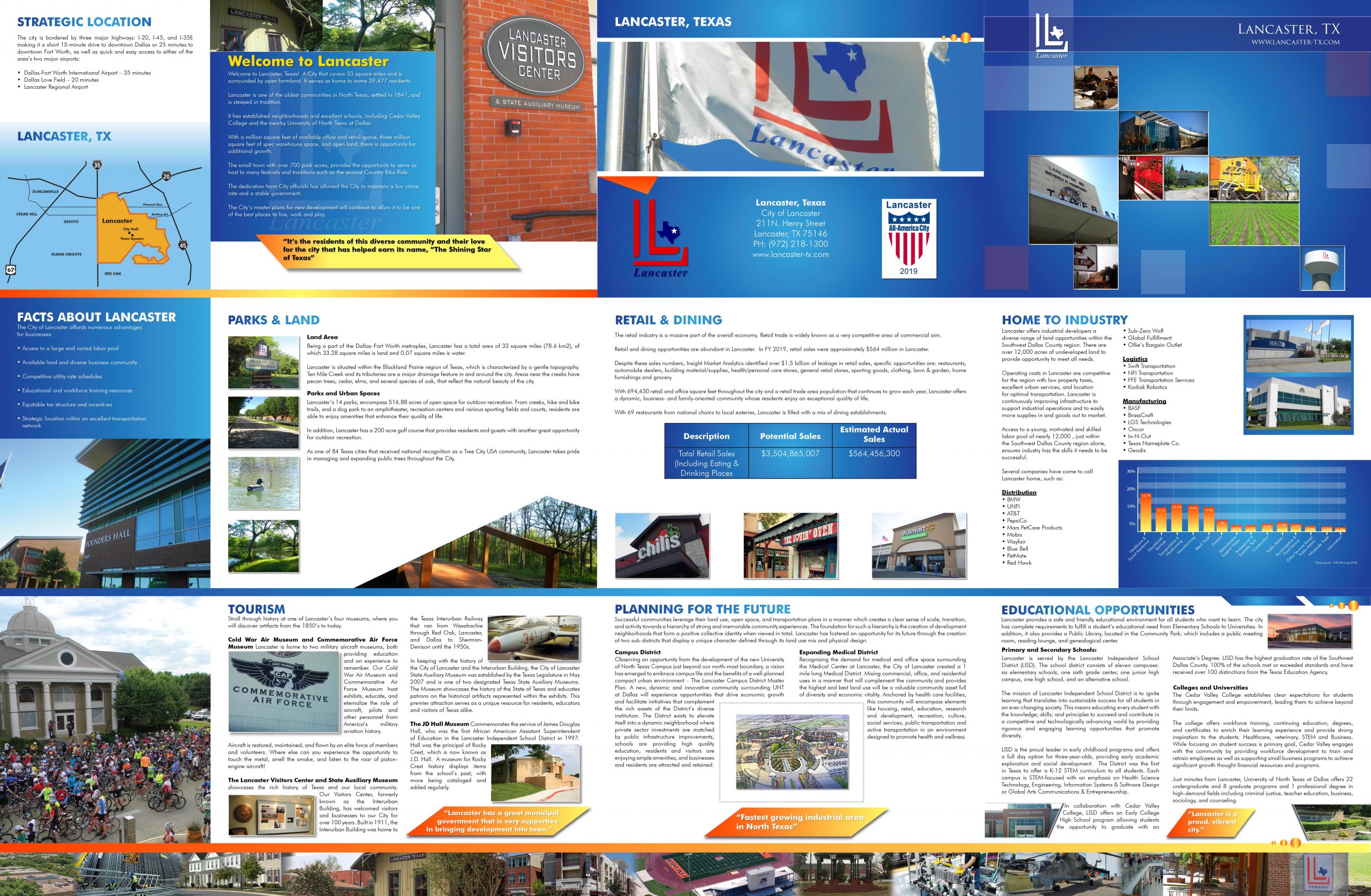
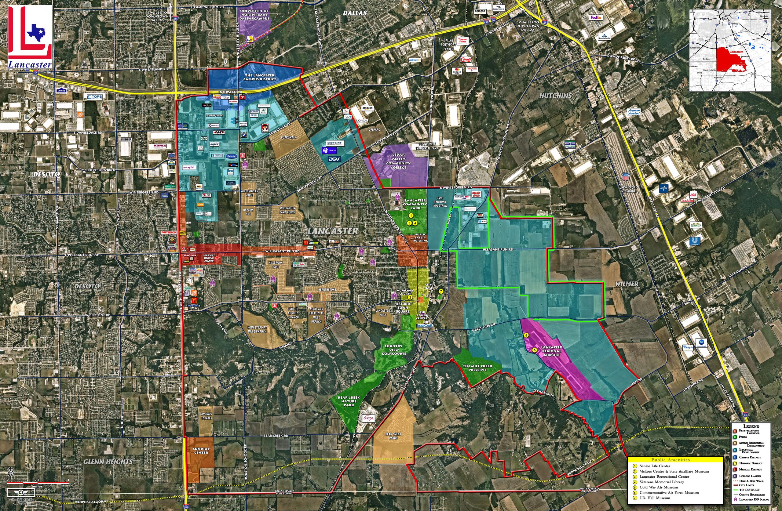
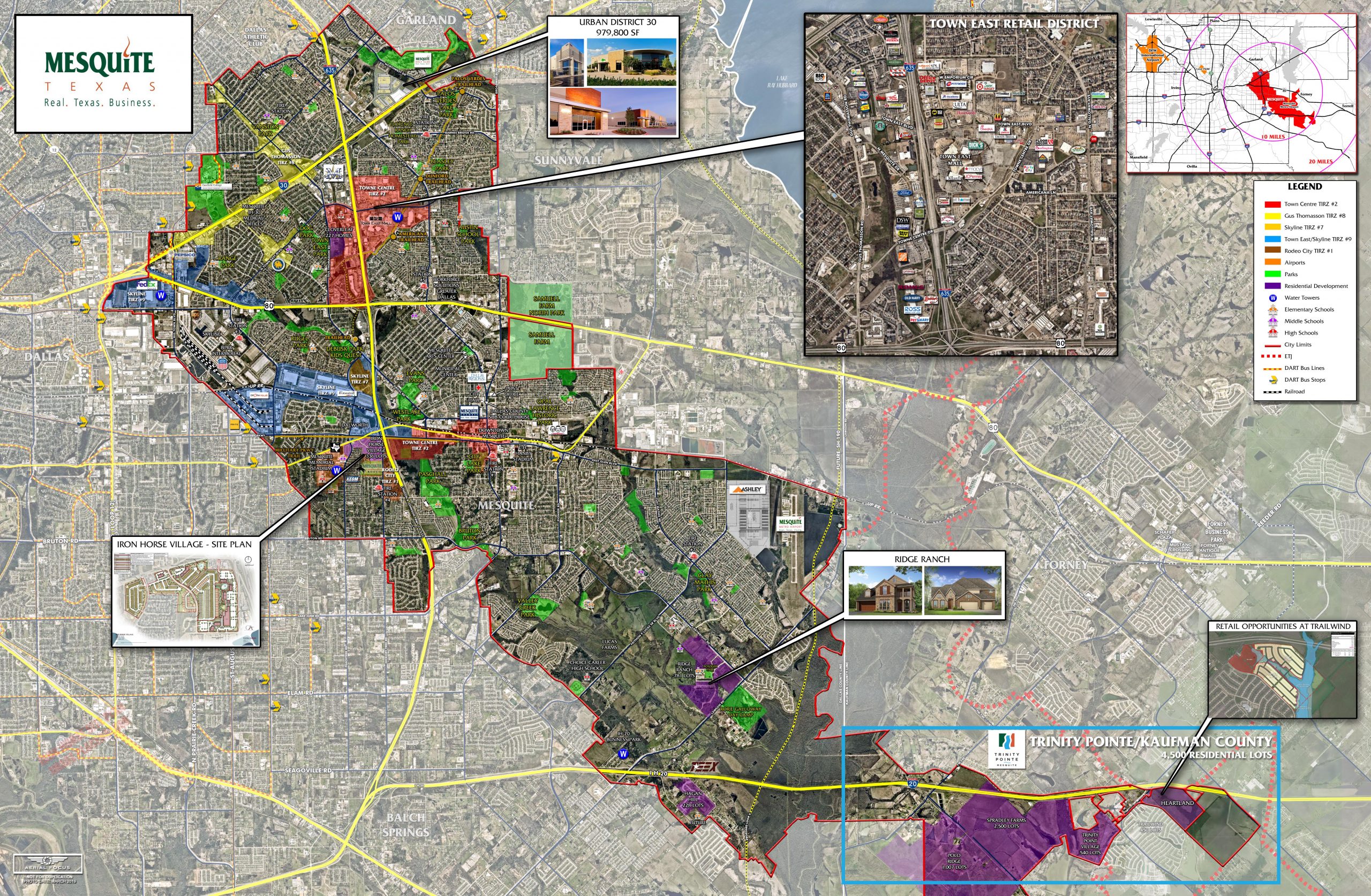
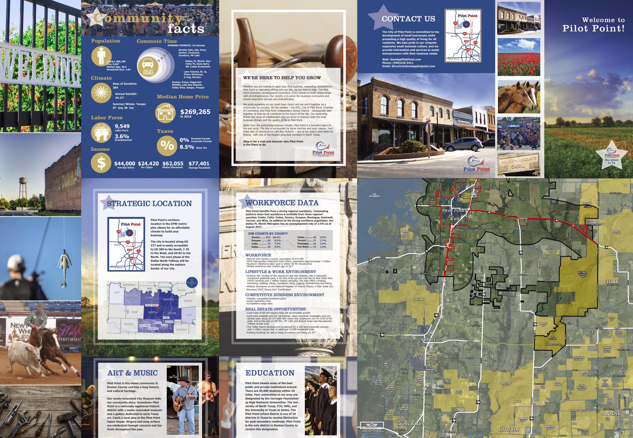
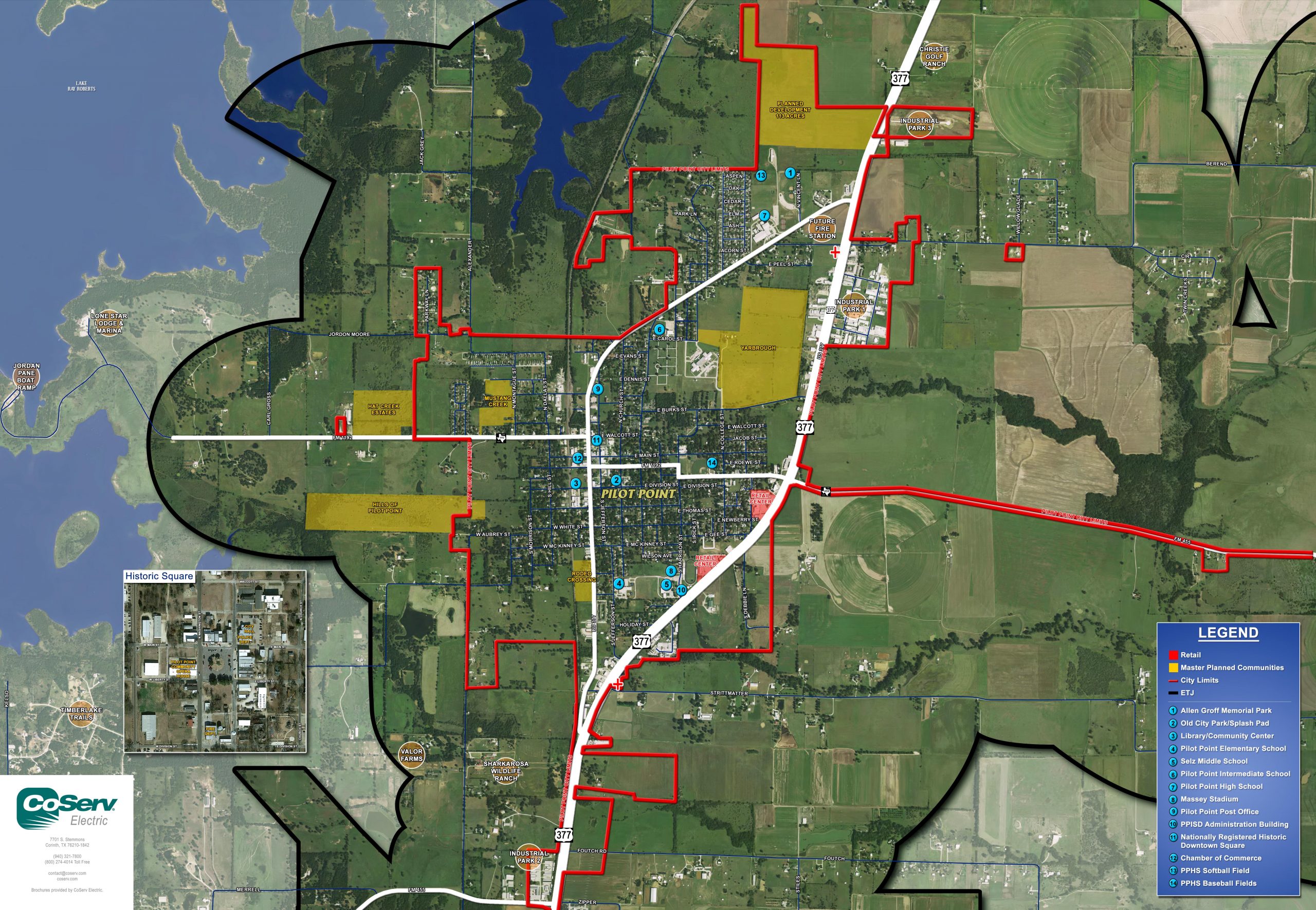
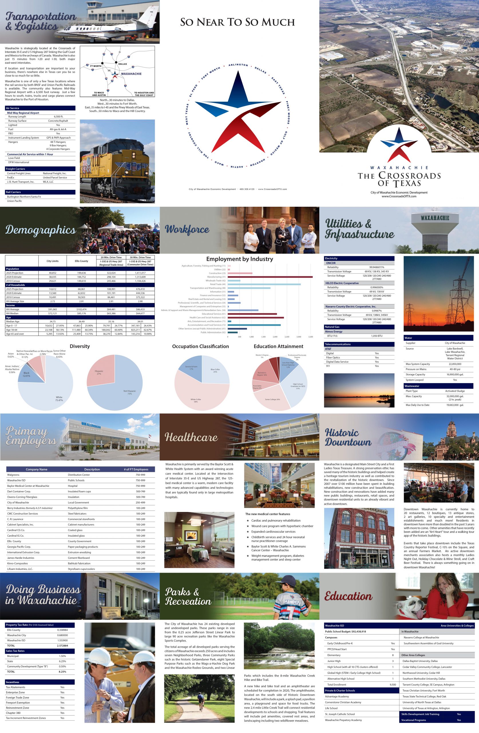
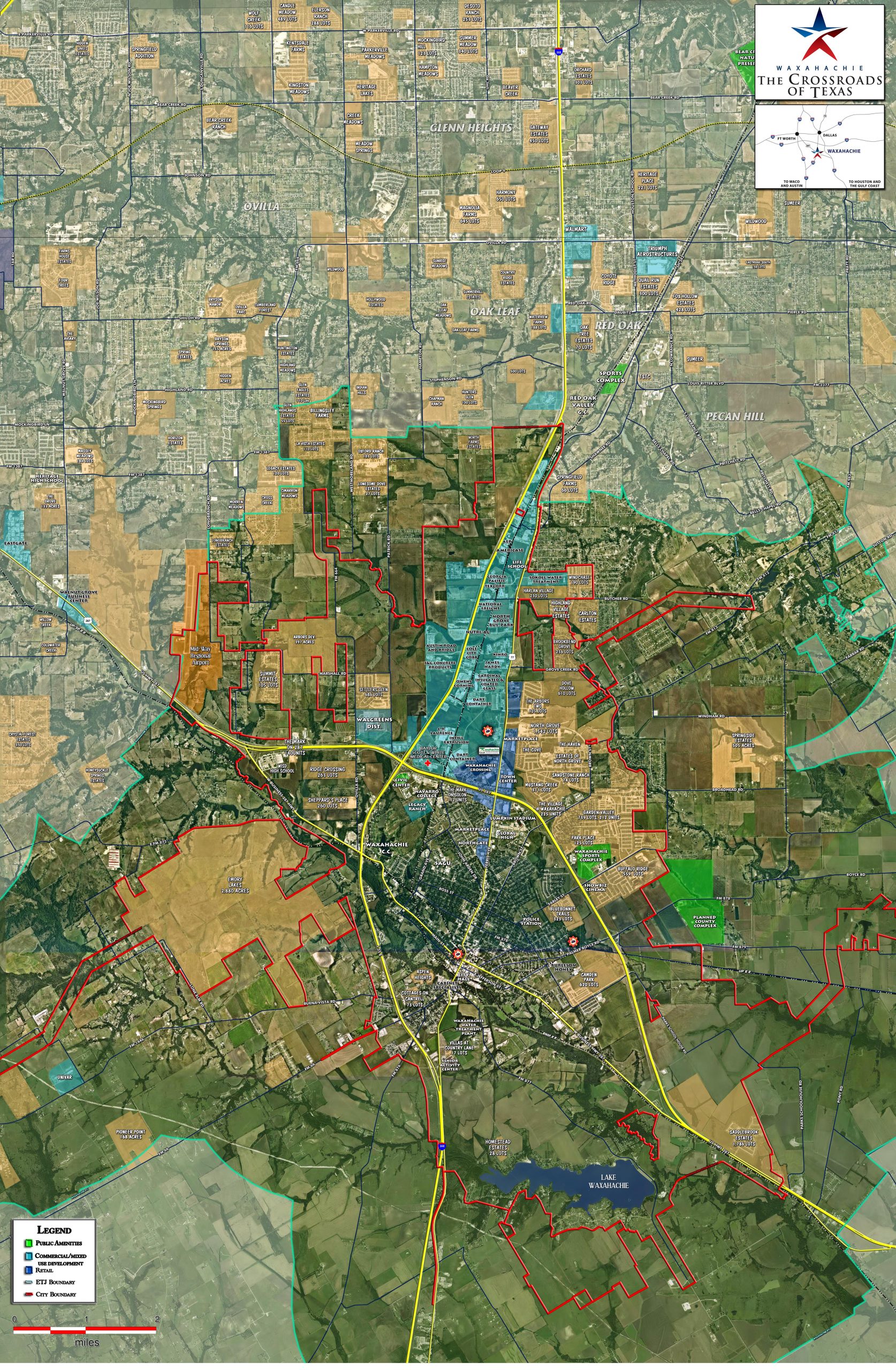
Flyer View’s map posters are the cornerstone product used by Economic Development and Real-estate Professionals across the United States. The ability to tell your story through the use of aerial imagery, GIS layers, graphics, labeling and branding is paramount in every project. By utilizing both sides of the poster we're able to create a single-source document that delivers effective messaging to multiple audiences.

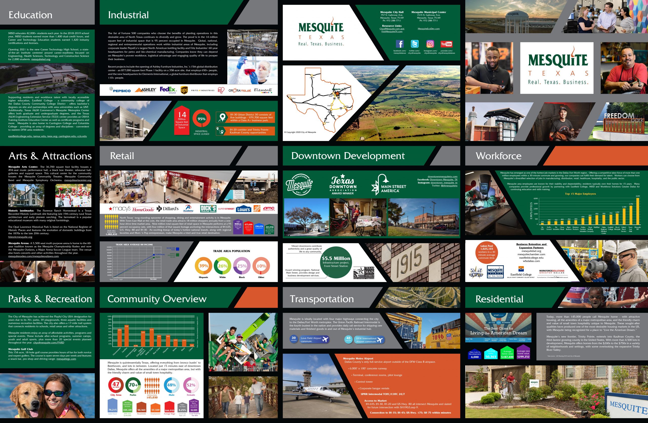
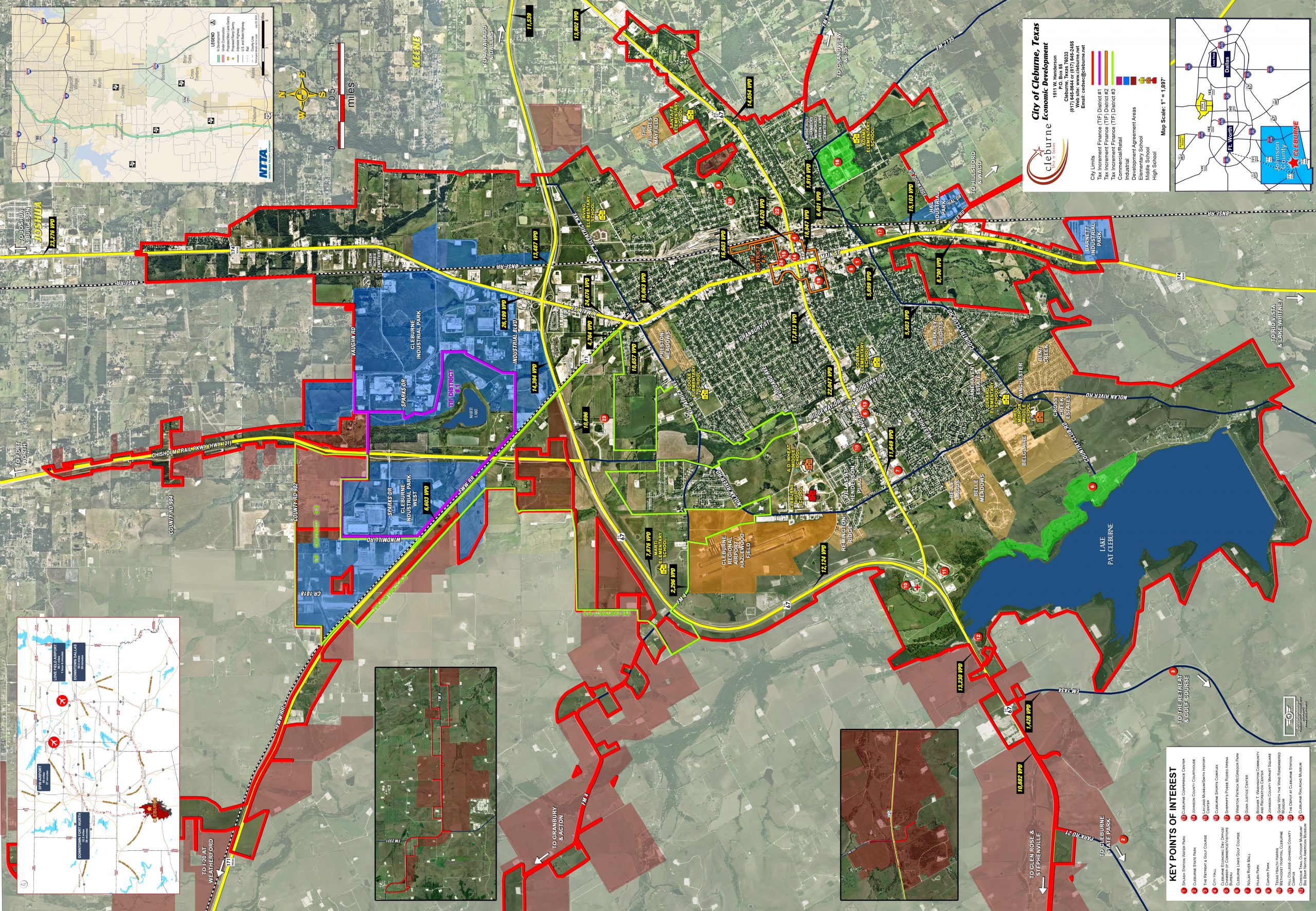
Project Gallery