
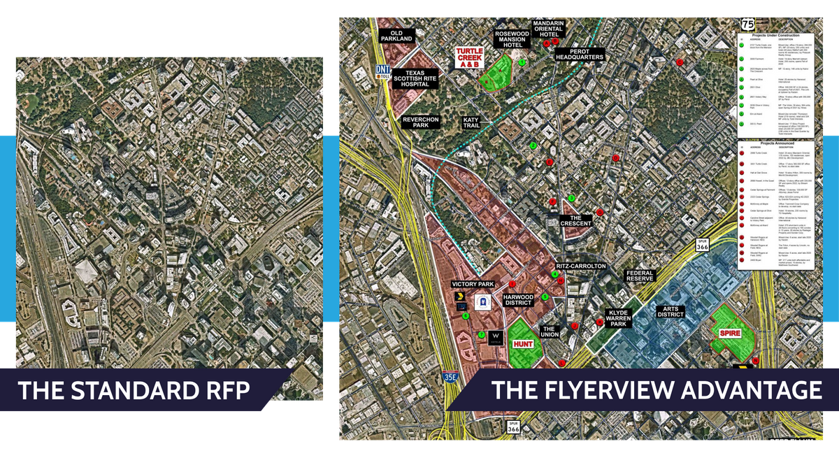
Winning Texas RFPs: 3D Site Selection & GIS Visualization
Win more RFPs and accelerate tax revenue by transforming raw GIS data into persuasive 3D visions. In the competitive landscape of Texas economic development, a flat map is no longer enough to win the day.

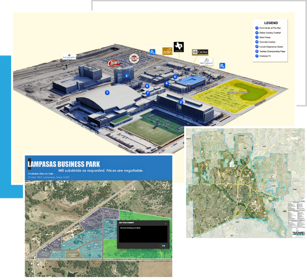
Start Your RFP Strategy with a Free 3D Site Mockup
Are you sitting on a prime industrial parcel or a downtown revitalization zone? Don’t let a lack of visualization stall your progress. Submit your parcel ID below to receive a high-level 3D conceptualization of your site’s potential.
Visuals That Secure Investment
In the world of economic development, you aren’t just selling land; you are selling a future. Site selectors and corporate executives are often reviewing dozens of competing municipalities simultaneously. To win, your proposal must move beyond the "technical" and into the "aspirational." FlyerView provides the RFP response tools for cities that turn data into a competitive advantage.
Shorten the Sales Cycle
Site selectors make decisions in seconds, not hours. When a site selector opens your proposal and sees a flat PDF, they have to do the mental heavy lifting to imagine what a facility would look like. Our economic development 3D renders eliminate this "visual friction." By providing a ready-made vision of the completed project, you move your city to the short-list faster because the decision-maker can instantly see the site’s viability.
Maximize Tax Revenue
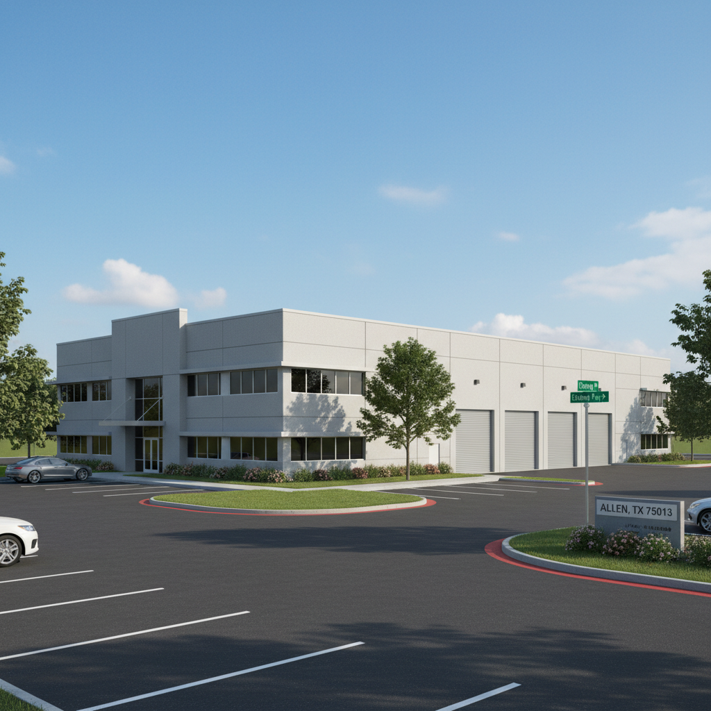
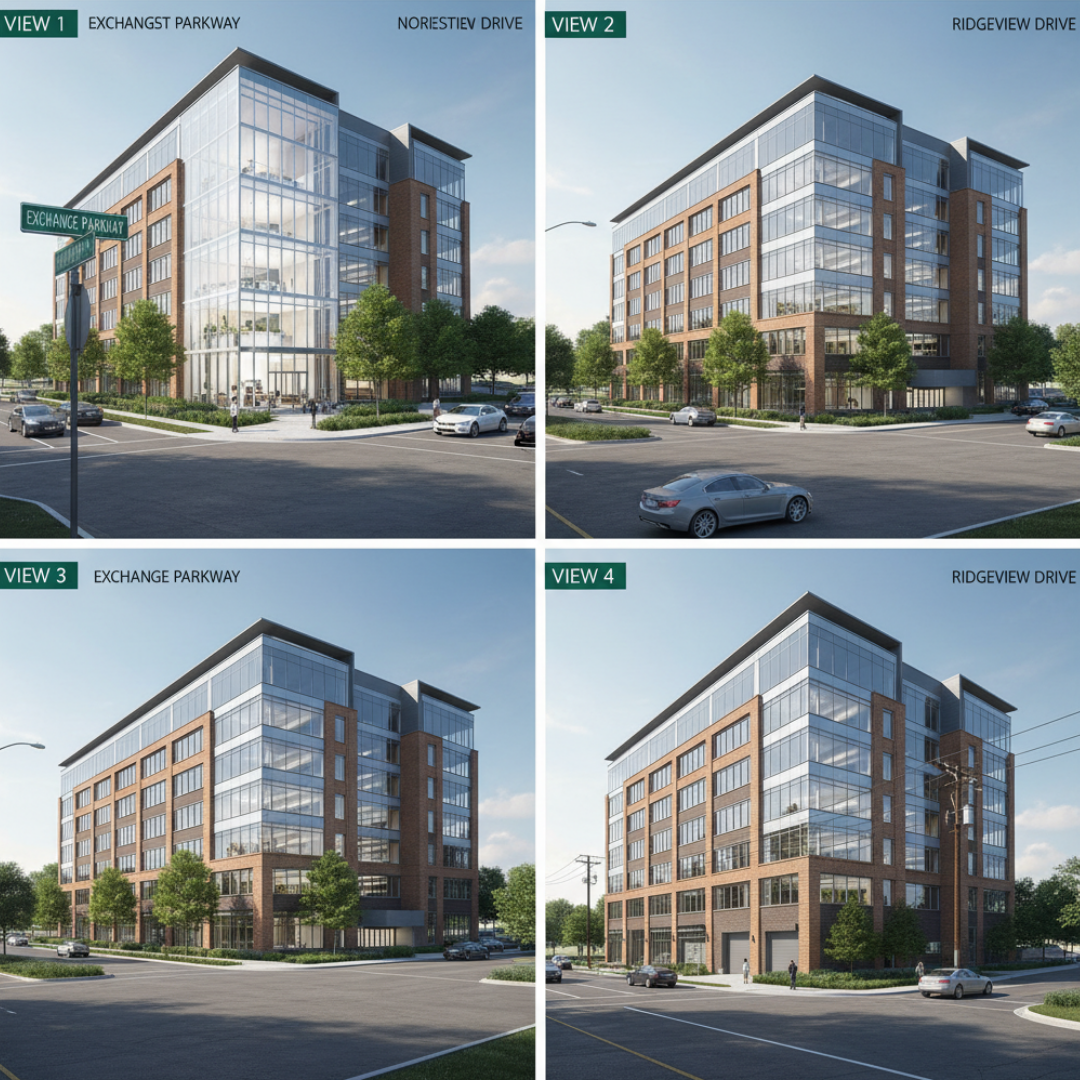
Every square foot of vacant land represents unrealized tax base. Traditional mapping often fails to communicate the true density potential of a parcel. We show developers exactly how much "roof" they can put on the ground. When you can visualize the full density potential of your land—including multi-story capabilities and optimized footprint layouts—you are effectively securing more future tax base for your community.
Job Creation Engine
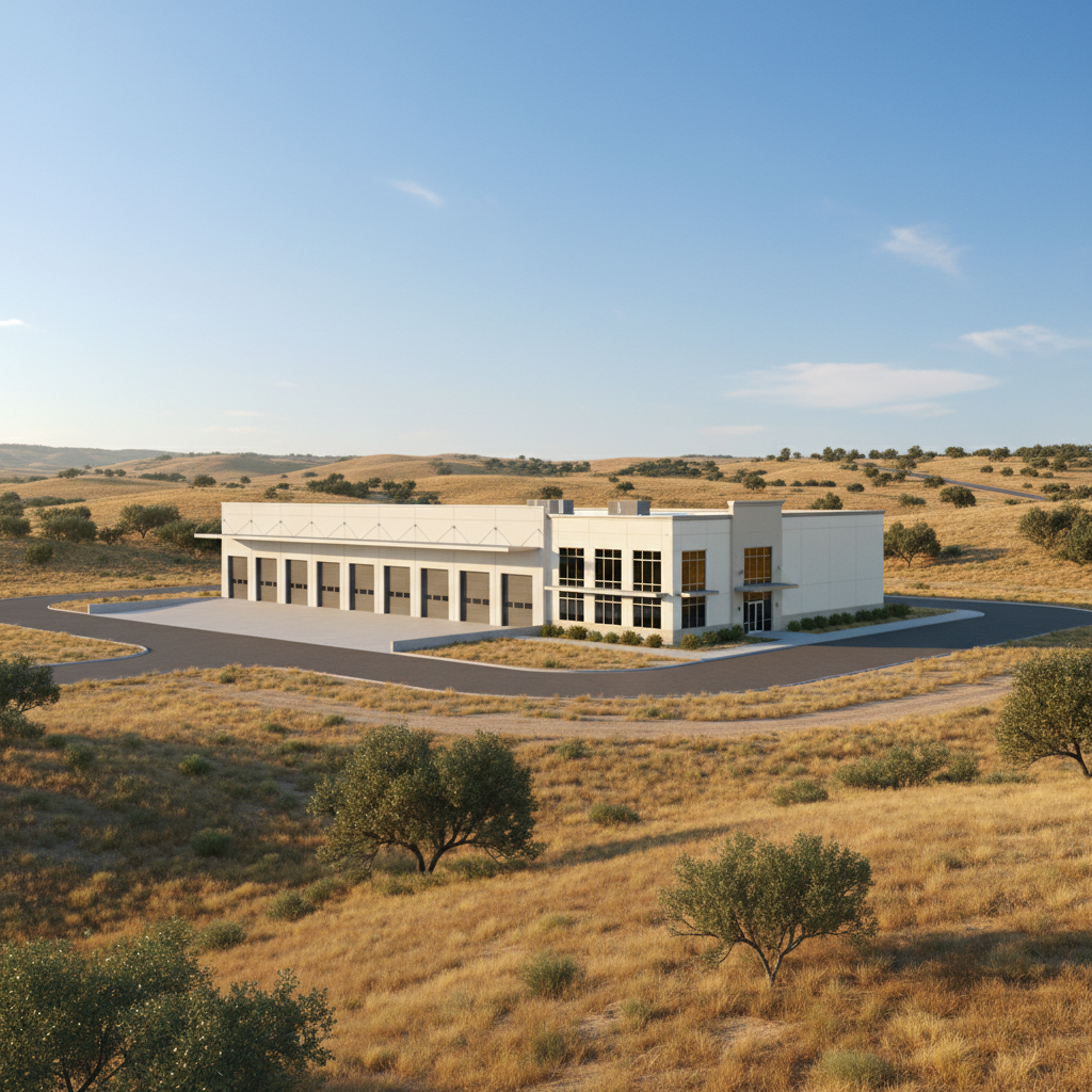
High-tier employers in sectors like Tech, Manufacturing, and Logistics require precision. They need to know that a site is truly "shovel-ready." Through our advanced industrial site marketing strategies, we visualize utility proximity, ingress/egress for heavy freight, and logistical flow. When a Fortune 500 company can see exactly how their supply chain integrates with your local infrastructure, they gain the confidence to commit, bringing high-paying jobs to your jurisdiction.
The "3D Rendering" Lead Loop (How It Works)
The transition from raw data to a high-conversion presentation shouldn’t be a burden on your staff. We have designed our workflow to act as an extension of your economic development team, functioning much like an intuitive site selection software but with a human-centric design touch.

Submit Your Site:
The process begins with simplicity. You provide us with a specific address, a parcel ID, or even a rough boundary on a map. We handle the technical sourcing of the geography.

We Layer the Intelligence:
This is where the magic happens. Our team doesn't just "draw" a building; we integrate your specific data layers—whether it’s Placer.ai foot traffic data, ESRI demographic layers, or utility specs. If you don’t have the data, we can generate it for you, creating a data-rich 3D environment that proves your site’s value.

Review Your Strategy:
We don’t just "send a file" and disappear. We deliver a comprehensive 3D mock-up and schedule a 15-minute "Site Strategy" call. During this session, we show you exactly how to present these assets in your next RFP response to maximize impact.
Why FlyerView is a Sole Source Provider
One of the greatest hurdles in economic development is the bureaucracy of procurement. Don't let the traditional 3-bid process slow down your momentum or cause you to miss a critical RFP deadline.
FlyerView Group, LLC is uniquely positioned in the marketplace. Because we are the only firm providing a proprietary, integrated GIS + Graphic Design workflow—merging the technical accuracy of geographic information systems with the aesthetic power of high-end marketing—we often qualify for Sole Source procurement in 90% of US jurisdictions. We provide a specialized service that cannot be replicated by standard engineering firms or generalist marketing agencies, allowing you to bypass the red tape and get to work immediately.
Proof of Performance - Case Studies
Our work isn't just about "pretty pictures"—it’s about measurable results. From the Texas Triangle to the West Coast, our visualizations have been the catalyst for billions in capital investment.
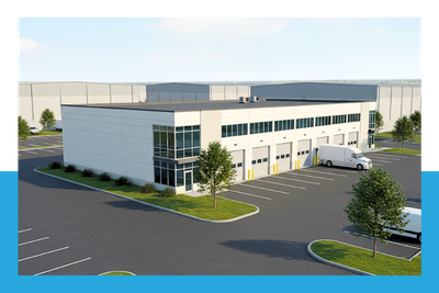
Industrial: The Logistics Hub at Port North
This project utilized high-resolution industrial site marketing to showcase deep-water access and rail integration. Result: Used to secure a $40M tech hub expansion and 500+ new jobs.
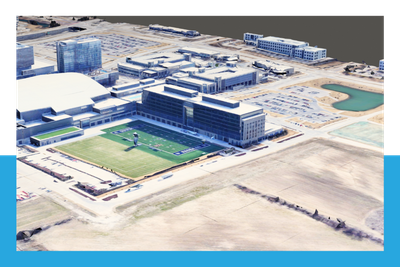
Mixed-Use: Downtown Revitalization District
We transformed a 10-block radius of underutilized lots into a vibrant, 3D-modeled walkable district. Result: This render was the centerpiece of a winning $15M State Grant application.
Logistics: Interstate 80 Manufacturing Center
- By visualizing the "last mile" logistics and truck turning radii in a 3D environment, we proved the site's superiority over regional competitors. Result: Visualized for a Fortune 500 site selection committee, currently under construction.
Clients That Trust Us

Your Next RFP is Already Counting Down.
The difference between a "Thank You for Your Submission" letter and an invitation to the final interview is often the quality of your visual narrative. In the high-stakes world of site selection, you cannot afford to go into your next meeting with 2D maps and spreadsheets.
Give your city the edge it deserves. Let us build your first 3D visual assessment today and show the world that your community isn't just ready for business—it’s ready for the future.